
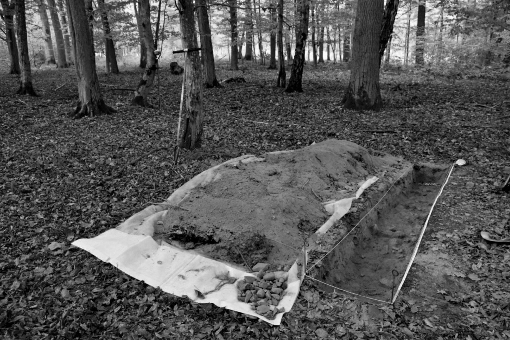
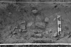
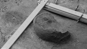
Scientists using airborne laser scanning technology to map a forest as part of a flood prevention scheme were amazed to discover a huge estate from the time of Christ hidden underneath an ancient forest.
The completely forgotten property shows clear evidence of a huge network of ancient cultivated fields, and also farms and other buildings that would have stood on the site before it vanished from the pages of history and was covered over by the forest.
The Archaeologists who reported the discovery also confirmed that there are even roads leading into a part of the estate that would have been part of a flourishing complex 2,000 years ago in the Tuchola Forest in northern Poland.
The team investigating are excited by the possibilities the site poses because unlike many other ancient settlements, it has been undisturbed since it became abandoned and was replaced by the thick forest in the Bory Tucholskie area on the border of Kuyavian-Pomeranian and Pomeranian provinces.
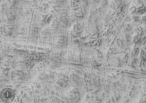
Mateusz Sosnowski, PhD student at the Institute of Archaeology of the Nicolaus Copernicus University in Torun, revealed: “Regarding research, it is absolutely unspoiled. It is very rare to not only discover a single element of the former settlement but also its surroundings: fields, farms and connecting roads.”
He said the problem was that later settlements often disturb the previous layout with the excavation and construction of new houses or roads, adding that the fact that this settlement appears to have remained intact in its original state after being abandoned nearly 2000 years ago makes it a unique discovery in Europe.
The settlement together with adjacent fields covers over 170 hectares. The exact arrangement of fields, bends, and even single crop beds are reportedly visible in the scans.
Reports state it can be seen how various owners were able to manage different fields which are surprisingly regular in size and shape indicating careful farm management.
The layout of the fields seems to have been using the three-field system, which was first widely seen in medieval Europe.
It was introduced after farmers realised that constantly growing crops in the age before fertiliser was available quickly strip the goodness out of the ground, resulting in successively lower yields.
Instead by automating the crops in which fields were harvested for two years, and then left fallow for a third year with only animals grazing and fertilising the ground allowed land to regain its goodness.
Airborne Laser Scanning systems are LiDAR systems which can be mounted on aerial vehicles such as aircraft and helicopters. The LiDAR (Laser Imaging Detection and Ranging) technology enables the automated acquisition of 3-dimensional data at a high rate. Weather and visibility hardly affect measurements, making these systems ideal for any surveying, inspection or mapping.
To find out more about the author, editor or agency that supplied this story – please click below.
Story By: Bartosz Staszewski, Sub-Editor: Joseph Golder, Agency: Central European News


